The territory no longer precedes the map, nor survives it. Henceforth, it is the map that precedes the territory.
– Jean Baudrillard (1983)
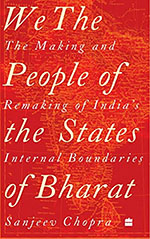
In a crucial scene set in an underground temple in Bankimchandra Chatterji’s Anandamath, the protagonist Mahendra first encounters the Motherland, as he goes into a dark room, and ‘Gradually a picture revealed itself to him. It was a gigantic, imposing, resplendent, yes, almost a living map of India. This is our Mother India as she was before British conquest,’ he was told. Then, Mahendra goes into the next room where he sees ‘a map of India in rags and tears. The gloom over this map was beyond description. This is what our Mother India is today,’ he was informed.
A modern nation state can only be imagined in the mapped form. If it were not for the map, conception of a nation state would remain an abstraction, leaving its inhabitants without any material means to relate to the country to which they would feel attached. Maps serve as markers of presence. A map enables the citizen-subject to take visual and conceptual possession of the nation-space that he inhabits. In fact, map making is an essential tool of the technology of persuasion. The territories/spaces, of course, can also be considered as shifting grounds which are themselves transformational patterns of de- and re-territorialization. Maps are texts that describe and redescribe the world, like any other document, in terms of relations of power and of cultural practices, preferences, and priorities.


Wow, marvelous weblog structure! How lengthy have you been blogging for?
you make running a blog look easy. The total look of your site is fantastic, as well as the content material!
You can see similar here e-commerce
My programmer is trying to persuade me to move to .net from PHP.
I have always disliked the idea because of the expenses.
But he’s tryiong none the less. I’ve been using Movable-type on various websites
for about a year and am concerned about switching to another platform.
I have heard very good things about blogengine.net. Is there a way I
can transfer all my wordpress posts into it? Any help would
be really appreciated! I saw similar here: Najlepszy sklep
It’s very interesting! If you need help, look here: ARA Agency
Howdy! I simply wish to offer you a big thumbs up for the excellent info
you have here on this post. I will be coming back to your website for more soon.
Top-Rated Seo Company in India
Here is my blog post; Seo Company India – Seohawk