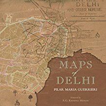
Maps of Delhi by Pilar Maria Guerrieri is a handsome publication collecting predominantly handmade maps of the city from 1803 to present day. A brilliant testimony to our erstwhile technical skills in cartography, the book is far more than just a souvenir of beautiful drawings. Instead, it is a visual history of one of the world’s largest cities in 44 maps told over two centuries.
The digital age has greatly altered our appreciation of map reading. However, it would be naïve to assume that analogue cartography is of little relevance to us in this age of freely navigable satellite imagery. Maps today are constantly and casually deployed to bridge origin and destination but they seldom served this exclusive purpose historically. As more of the world was discovered, the development of cartography itself was integral to document new cultures and peoples as much as it was to record terrains and routes.
In its publication, Guerrieri’s Maps of Delhi therefore prompts us to appreciate two inescapable contemporary issues: The first is whether scrolling endlessly through Google Earth’s aerial views could ever rival the nuanced reading of socio-cultural and geo-political issues amply provided in analogue maps. No doubt that it is only a matter of time that Geographic Information Systems eventually replace all traditional cartography but it is worth noting that mapping and representation methods used today have largely sprung from centuries of perfecting sophisticated methods for manually surveying and recording vital layers of information beyond the obvious.

